Trent Severn Waterway...
August 6 - 15, 2023

This waterway was evaluated in the early 1800's for Canada's protection from the United States for moving troops and supplies. Ultimately, it was not deemed a good solution for this purpose. But in the 1830's the government discussion centered around providing safe passage for items throughout the middle of Canada or "upper Canada" as it was known in those days, The Trent Severn Waterway was built over an extended period of time as finances and needs of communities became apparent. The first lock in Bobycageon was built in 1833 and the waterway was completed as it is now in 1920. As trains became a common way to transport items, the locks fell out of favor except in those areas where the train couldn't reach which was usually around the lakes in Ontario. The fact the waterway was built over an extended period of time allowed for different technologies to be used in its completion. The use of hydroelectric power in 1907 allowed the locks to incorporate this into the lock system. The waterway has 44 locks and is 240.5 miles.

Prior to leaving the Marina in Trenton, I walked around town looking for historical information. I did find that Samuel de Champlain and a small group of Frenchmen along with 500 Huron Indians passed down into what is known now as Syracuse in 1615 to fight the Iroquois Indians. The War Party of Champlain's was not a success and made the Indian tribes become even more hostile to the French settlers. Leaving the Trent Port Marina, we were met with the sign announcing we were entering the waterway. Our initial plan was to get through the 1st 6 locks to Frankford. After talking with Steve and MC at the Trent Port Marina (they were tied up behind us), Beach House and us agreed to move ahead and try to get through 12 locks to Campbellford. The town is a small river town with a nice downtown. Earlier this year we met and travelled with Dody and Steve Sharpe who are from Campbellford. They were home and met us for dinner. Like many of the small towns we have been in Canada, most shops and restaurants are closed on Monday so there were limited options. This Monday was also a holiday called civic holiday. I asked many on Sunday and Monday what kind of holiday it was and no one could really tell me. Some simply said a day off. Nevertheless we enjoyed seeing them and had a good meal. Steve and I decided back in Delaware we were probably long lost relatives from England as his family spelling was Sharp and added the E when coming to Canada. They own the local grocery store in town- Sharpe's Market which I visited before leaving town. Danny had what he said was the best beer he has had in Canada- Church Key Lager. The brewery was not open and the restaurant emptied the keg. We continued to look for the beer in The Beer Store and the LCBO but to no avail. So unfortunate for Danny. Another claim to fame in Campbellford is Dooher's Bakery. It has been named the best bakery in Canada multiple times. They open at 9am although sometimes we were told there are lines around the building so I went there at 8:30am. The girl in the bakery I think felt sorry for me and let me in at 8:45 with Danny, David, and Roxanne not too far behind. They did have good stuff! The artist who designed the $2 coin is also from here.


The double lock at #16 and #17 was so tall, we couldn't get a selfie, so I got one of Danny. We saw thin canals suggestive of the Great Dismal Swamp in some places.


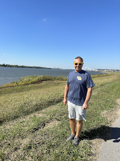
Our next dilemma was whether to go to Peterborough or stop at the small town of Hastings. We needed to cross a 15 mile lake with winds stated to be 10-20 MPH. We could have made it but one of the locks had some mechanical problems and we got delayed. Hastings had space on the wall and there were a number of looper boats tied up. The Other Woman and Beach House got the last 2 spots. I walked through town and down to what they called a beach which did not fit my definition but I did get a sand sample! Found a great place to eat at McGillicafey's Pub & Eatery and all the loopers met together for a fun dinner discussing how to spell "AY" at the end of every sentence. The Canadians with us said it is spelled "EH", we all had our own answer. The dinner gave Danny and me a chance to meet some Loopers who we did not know. You can see the Other Woman along the wall in Hastings.


The history of Hastings and the dam at Hastings in 1844 had some interesting history. There was no specific policy for the regulation of water levels which affected many people. If the millers and lumbermen got the amount of water they needed then operators of steamboats wouldn't have enough water for depth to operate their boats. But if the water depths were adequate, then the farmers would complain the water would drown their land. Ultimately, improvements to the dam were made and regulations were developed to make these issues fair for everyone.
Woke up before sunrise to be ready to push off in hopes of getting to the town of Peterborough, their famous lock, and as far as we could get going west. The town was another quaint downtown area. This part of Canada is called cottage country and many people from Toronto own summer/weekend homes here as it is 1-1.5 hours away. Danny checked out the Beer store as we did not see any brewery to visit. We did have a good BBQ lunch, picked up groceries for dinner tonight got diesel and moved on to the lock. The Peterborough Lock- #20 was built in 1904 of unreinforced concrete. There are 2 water filled steel chambers you ride into (think big bathtub) and then get raised 65 feet in the air. We got the video from the front and Beach House did the video from the back. It took 2 minutes for the pistons to move and raise us the 65 feet. It was a very smooth ride. The Dockmaster in charge of this lock is Eddie. The people we met in Trenton- Steve and MC told us his name. MC and Eddie went to high school together. I spoke with Eddie before we left the lock and told us MC's Mom taught religion when they were in school. I believe he has been at the lock for 30+ years.


As we travelled through, Lock #22- Nassau Mills showed a stick stating how many kilometers to other locations. We were able to get to Lock #24 on the top side at Duoros Lock and spent the night on the wall with Beach House and Dawn Watch. Dawn Watch is Jim and Dawn Brace's boat from Texas. We had dinner, enjoyed sitting outside and finished the night with peach crisp(from Dooher's Bakery) with vanilla ice cream. I got a chance to see cattle across the rushing river as well as a guy fishing off the rocks.


While traveling we got to see all types of activities on the Waterway. We enjoyed talking to people while waiting for locks, having people wave as we went by, tried to be nice to the people on canoes and kayaks, and people taking pictures of our boat name and chuckling.


There is rarely room at Lovesick Island plus there was to be terrible storms which would make it less likely we would stop but we can always hope for the weather to be wrong! During the storm we did get to appreciate the Canadian Shield which is ingenious rock rather than sedimentary rock. This was explained to me by Wendy, a geology teacher on the Loop from Canada. She said the rock formation would get better as we go further north in Canada. There was a very neat church- St Peter's On the Rocks (they hold services in July & August) we saw as we passed in the pouring rain not to mention many beautiful houses and boathouses.


There was no room at Lovesick Island not to mention that horrendous storm with pouring rain, so we travelled on to Bobcaygeon. Danny and I thought this town was named after someone but found out it is an indigenous name for "at the very shallow currents." This town had the 1st lock in 1833. All of the marinas were full due to it being a weekend but were able to find Happy Days Marina (a former houseboat rental marina) that were kind enough to accommodate us out in the country. The couple that own it have their 3 sons working there and could not have been nicer. Drove us into the downtown which was about 6 miles, picked us up and took us to a wonderful Mennonite bakery in a family home. They were very strict Mennonite as they are only allowed power for their work and have none in the house itself. Frank the owner of the marina told us, many of the Mennonites had come from Mexico and the ones from the United States came due to the lower cost of land to farm. He said they had a significant community in this area.


While we planned to leave Bobcaygeon, the weather had improved overnight or so we thought. When we arrived at the lock, it was like playing musical chairs except with boats. Some were waiting to go through the lock, some were trying to get a better position on the lock wall to stay overnight because they had power, and some just looking around and making for traffic tie ups! You will notice Danny at the back of our boat talking to the couple behind us. We were lucky to also have beside us, a nice family with 2 cute kids waiting to go through the lock with us. We got through the lock even though I untied us too soon. Our usual sequence is when I hear Danny start the engines, I untie the boat. Except this time, Danny says he told me not to untie until he told me to do so. Unfortunately for him and fortunately for me, I was listening to Elton John on my headsets and did not hear him. Danny responded quickly to getting us out of the lock so as not to hit anyone! YIKES!
Anyway, we continued on our course although had hoped to spend a couple hours in Fenelon Falls BUT we had a hellacious storm with lightning, thunder, and sheets and sheets of rain from different directions. The locks are not allowed to operate in these conditions and each lock is located next to a dam with rushing water. So Danny and I communicating by headphones decided, I would go downstairs standing in the middle of the covered back of the boat and when he makes a move to go to the wall, I will tie the boat off at the spring line(the middle of the boat). There was significant runoff from the streets into the river also pushing against us. We chose to tie off on the other side and waited out the storm. Fenelon Falls was not meant to be. The night would be spent at Lock #37 in Bolsover. Those very narrow canals and seeing the rocks so close to the water and THE BOAT continued to be scary! We crossed through, The Hole in the Wall Bridge built in 1905 which is the earliest known reinforced concrete bridge in Canada.


Beautiful sunset after those storms passed. The storm in the picture you see with dark clouds went to the north of us, thank goodness!Our next place to tackle was to cross Lake Simcoe. We had been told by many people, weather could turn on a dime and wind and water could be dangerous. The forecast was winds of 12 MPH with gusts up to 35MPH. By the time we got there it was still 12 MPH but gusts now were up to 42MPH. Beach House was in front so we let them make the call but I had found a few bailouts along the lake if we needed to stop. They chose to move ahead. While it was a little rough 2-2.5 ft waves, the 17 miles crossing was only bad during the 1st half, so about an hour. Danny and I agree between what we endured in the Atlantic off the New Jersey coast and past outings in the Chesapeake Bay, it was tolerable. As we came into Orilla, we had to pass an area called The Narrows. According to history, this is where the Indigenous people would set up fish weirs. These fish weirs made with wooden stakes would capture fish in narrow areas. Carbon dating of some of the wooden stakes found here go back 5,000 years. We stayed 2 days in Orilla. This town is best known as the home of Gordon Lightfoot. Sadly because our arrival was Monday and left Wednesday, many places were closed. We found great places to eat, Italian and Thai and took a tour of the town through an app the city provided. Wilkie's bakery and Mariposa Market also had some great desserts and breakfast foods. At Wilkie's, they are known for their Chelsea buns. You had to buy 6 or 12. I had to try them so we bought 6. They were good but a nice cinnamon bun would be better in my opinion. This area is where the Indians agreed to treaties with the British (in 1798, 1815, and 1818) to give their land. The land obtained were given to seamen and veterans who participated in the Revolutionary War and War of 1812.


The fire department in Orilla had a very tall portion. While the building and brick were beautiful, the tall section of the building was not there for appearances. It was used for the firemen to have their firehoses fully extended to dry out after use. While doing the walking tour, the former City Hall had been transformed to an Opera House for programs and concerts.

Making our way further north, our plans were to get to at least the Big Chute, more about that in a minute and preferably to the last lock- #45, Port Severn. The Big Chute is another engineering marvel. Your boat goes into a wooden bottom crate into a sling and it moves you over land into another lake. Our understanding was this was done because they had failed numerous times getting a lock built. We also heard it was done not to mix aquatic life from the 2 lakes. So who knows...but you can see the wooden structure or railway as they called it and the belts as we are driving into the "Big Chute".


Next to this lock is this beautiful view over large rocks.. The lock had experienced a problem with a broken strap and we were delayed getting through the lock. We went on the trip down before Beach House, who went on the next trip. Waiting for them to come out, as they too were in the back like us, notice the Kayakers in their yellow boats. They were allowed to leave first after that platform gets immersed in water so they could get out of the way of the pontoon boat and the Beach House! Even with the delay, we made our reservation to Port Severn.
The rest of the travel to Point Severn was fine and got to see beautiful homes and yards again. Danny saw this pile of wood and said that should tell us how cold it gets here, I would say pretty cold. Also this great tree swing which is labeled not only here but also on the water map, notice the yellow ladder to get to it...LOL

Next was Lock 43, Swift Rapids and there was significant current but we did fine. In the standard locks, this was the biggest change which was 45 feet going down.


And finally, the last sunset and the last lock of the Trent Severn Waterway. The small mollusks inside this old bollard in the picture were spitting out water while we were going down in the lock. I did take a video too! I saw a wood carving shows all the locks right to left from where we started to where we ended. Then we also had the paper map as well. And finally, we were able to see a Loon bouncing around on the water.


Capitalism in Canada was seen in the cannabis business. This is a very SMALL sampling of businesses. We saw some towns with 4 within a block so I don't know how they survive. Did not go inside any of them.


Comments
Post a Comment