GEORGIAN BAY...
August 16 - 23 , 2023

Georgian Bay has often been referred to as the 6th Great Lake or the Land of 30,000 Islands. The size of the bay is 160 miles long and 80 miles wide. There has been findings that hunters and gatherers were in this area going back to 9000 BC. Champlain and Jesuit priests explored this area as well. In this area of Canada you get to appreciate the Canadian Shield and ROCKS!!!! The Canadian Shield is the exposed continental crust. While this is found throughout North America, it is deep underground and not exposed. This crust appears to be 1 billion years old. The Canadian Shield represents 50% of Canada's land mass. Leaving the last lock you could tell a difference in the terrain. There were less trees and more rocks of
different colors, shapes, and sizes. And homes of different shapes and sizes including mobile homes to large brick and stone homes. I took a picture of Red Rock Lighthouse and a place called 8 rocks(2 underwater, of course).


Our first adventure was to Beausoleil Island at Frying Pan Bay. Canada Parks own the entire island and there are numerous bays and coves. The decision of where to go is most dependent on the direction of wind. We went into Frying Pan Bay first in hopes of finding a place to tie up on a dock due to expected high winds. When we entered the bay, it didn't look good but we lucked out as we find 2 slips that were hidden from view. I think The Other Woman looks pretty comfortable.


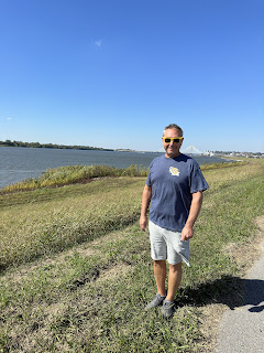
Danny and I hiked on San Souci Island which was interesting as the paths were not clearly marked. When was the last time you saw a working phone booth? I guess many do not have a cell phone not to mention coverage. The teenager was calling his Mom.

With good weather forecasted, we left Henry's looking forward to Parry Sound. Parry Sound is the home of Bobby Orr, a famous ice hockey player when I was growing up. The time to get to Parry Sound did not take long although we did have some narrow channels, one which as we were coming through with boats ahead of us, we were greeted with boats waiting for us to pass so they could come through going east. There was also a swing bridge operated by the Wasauksing First Nation. It was originally built in the 1880's for rail cars and replaced in 1912 for rail and car use. The bridges only opens every other hour so it is important to be there earlier than you need to be, just in case.

On our arrival to Parry Sound, we tied up at Big Sound Marina which was at the base of the downtown. Great location for walking to stores, restaurants, beaches, and walking trails. The town was named after Sir William Parry, the arctic explorer and took an active part in World War I and II in the development of munitions for Canadian troops. Like most areas in this part of Canada, lumbering and fishing were the main sources of employment. Later in the town's development, it became a place to unload many tons of salt off ships. Chemical additions would be made so the product could be sold as road salt for use during the winter season.


Bobby Orr Hall of Fame Center was having a Car Show with a 1968 Dart Swinger, which Danny loved.
During World War II, the Algonquin Regiment built bridgeheads over rivers and canals so the 4th regiment could advance in Europe. They had an indigenous saying that went- "we lead, others follow." This was a beautiful tribute to them.


The one thing they had handouts on but I did not see or want to see was- a Massasauga snake!I was told this poisonous snake was shy!(Who interviews a snake?) Apparently it is well protected by the government. If you are found to have killed one it is like 250,000 dollar fine and jail time. There is a Provincial Park named Massasauga as well which we saw from the sea plane. As heavily wooded as it was, I am sure you could find plenty of snakes there.


The Other Woman anchored in Kilcoursie Bay where we went ashore for some hiking for a few hours. While traveling in this area, you would see rock cairns throughout up on rocks or piers. I took a picture of one of my favorite ones. On our hike there was mention here of "The Wind Swept Tree" which I wanted to see. It was a few miles and doable although Danny didn't think much of it. When we did a selfie there, he mentioned it looked like the Charlie Brown Christmas Tree. On our way out, we passed by Pretty Rock Beach(I wish we had hiked there too) and Lighthouse Point at Kilcoursie Bay.


Now it was mid afternoon and we had to decide where to anchor for the night. We had several options and ultimately decided to go to Regatta Bay on Franklin Island. Regatta Bay was so named from a former YWCA camp that taught sailing in the summer and had regattas. There were only 3 other boats there. After David and Roxanne's dog got situated, we all went in our dinghy to Gilly's restaurant at Snug Harbor. The food was great and enjoyed it. I had found information that this island had an area with fossilized rocks on the shore. Despite researching it and talking to multiple people, I came up with nothing specific and Danny was not interested in going up and down the harbor slowly where some people had homes. So back to the boat we went for a beautiful sunset and a ride by the Snug Harbor Lighthouse.


Now it was time to go further north in Georgian Bay. While the day was beautiful, it was cold- 59 degrees. The scenery was wonderful with flat water. After we had been out for about 45 minutes, we got a Coast Guard radio transmission for small craft advisory for Lake Huron which is further north. Prior to lighthouses, navigation in Georgian Bay was done with piles of stones. We travelled down the channel to Ponte au Baril Lighthouse (Point with a barrel). The lighthouse was built in 1889 and prior to that the people who lived here set up a barrel with a lit lantern on top to assist those on boats. The community shared the responsibility for maintaining the lantern. You can see the bucket for the light on top of the rock.


We saw this wind farm going into Bying Inlet but got closer leaving the Inlet going north. This wind farm was quite large. In talking to the woman at the marina, she told us these were built on indigenous lands. Those people were given a large amount of money which was used to improve their community in addition to having a guaranteed employment there of at least 50% at the wind farm. She said they were dirt poor and had significantly improved their family's life and appeared happy.
When I put in the route for our travels today in Navonics, Danny didn't like the route. Our usual routine is I do either an automatic routing or manual routing to where we are going and then he examines it for issues. The Hangdog Channel(no kidding) had too many shallow spots (we have had enough of that), so we opted to go out in Georgian Bay. The depth charts on paper (we have these) and Navonics (on iPAD) have depths listed. In Georgian Bay, this is referred to as depth at datam. Georgian Bay, North Channel, and the Great Lakes have their water levels published every week. Last year the depths were 4 feet above datam, this year it is about 2 feet above datam. The governmental agency sends out an email every week which I receive. The email breaks down water levels by lake and comparison to previous measurements. When looking at the water levels you also have to look at the direction of wind and its impact on the water levels.

I thought this was an interesting passage- Free Drinks Passage. We did not get to travel this way. Originally, we were planning to go to The Bustard Islands to anchor and dinghy BUT wind and its directions were against us the day we travelled and more importantly the following day, so we had to bypass the Bustards and go to Killarney which is the end of the Georgian Bay and the start of the North Channel. As we approached Killarney, we saw the La Cloche Mountains. While you see white, this is not snow but it is quartz.


We arrived at Killarney Mountain Lodge and we may be here for awhile!
Locks 133
Bridges Openings 48
TOTAL MILES TRAVELLED 4504.20 miles
TOTAL DAYS 283
TRAVEL DAYS 104

Comments
Post a Comment